|
|
Welcome to Whitchurch Walkers Walking in and around Whitchurch Shropshire - a Walkers are Welcome town Walks programme Local routes Footpaths & P3 News Facebook About us Membership Contact Walking Festival Walking Groups Walkers are Welcome
|
|

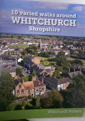
| 10 varied walks
around Whitchurch Shropshire and the Whitchurch Wheel |
First launched in 2014, the second edition of the
book details 10 walks of varying lengths
around Whitchurch plus the Whitchurch Wheel [see below] It is available for £6 from BookShrop in Green
End, Whitchurch Museum and Heritage Centre, Whitchurch Library and the Tourist Information and
Community Hub at the Civic Centre. Route maps for individual walks can be downloaded but you will only get
the photos plus historical and other nuggets of local information by
buying the book!
|
For route maps and descriptions: click here |
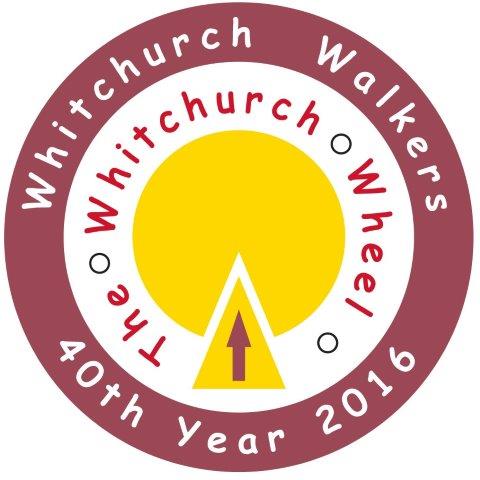
| The Whitchurch Wheel | Created
in 2016 to mark the 40th year of Whitchurch Walkers launched at the
2017 Whitchurch Walking Festival, this is a 15 mile circular route
around the town. Whitchurch is still at the centre of an important
cheese-making area so the Wheel refers to a wheel of cheese. It can be
walked as a whole or in wedges taking a variety of local footpaths to
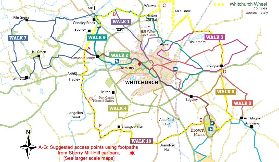
link with the Wheel itself. The Whitchurch Wheel is featured in 2020's new edition of the book above, meanwhile detailed maps and descriptions of the route, with links from town centre [Sherry Mill Hill car park] can be downloaded. |
Downloads Clockwise Anticlockwise |
| The Shropshire Way | One end of the Shropshire Main Route is at Grindley Brook, just north of Whitchurch. The route from Grindley Brook runs from along the Llangollen Canal and Whitchurch Waterway Country Park before passing through Jubilee Park and the town centre before heading south via Brown, Whixall and Bettisfield Mosses. | Full Details can be found on the Shropshire Way website |
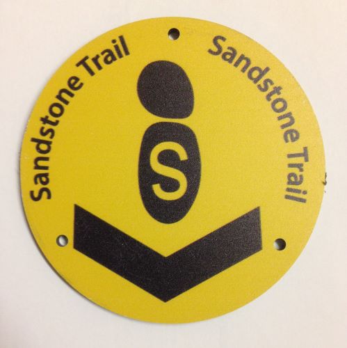
| The Sandstone Trail | This 33 mile route along Cheshire sandstone ridge starts from the Centre of Whitchurch in Sherry Mill car park [free] next to Jubilee Park. Here there is a Sandstone Arch and an information board. | More information on the Sandstone Trail website |
| The Maelor Way | This route heading westwards into Wales also starts from Grindley Brook. It links six long-distance paths: the Sandstone Trail, South Cheshire Way, Marches Way and the Shropshire Way in the east with Offa’s Dyke National Trail and the Ceiriog Valley Walk in the Wrexham/Shropshire Borderland to the west. | For full details click here. |
| The South Cheshire Way | Another route starting from Grindley Brook and running for 34 miles to Mow Cop, east of Kidsgrove. At the regional level it links the Sandstone Trail, Shropshire Way, Maelor Way, Bishop Bennet Way, Crewe & Nantwich Circular Walk, Cheshire Ring Canal Walk, Staffordshire Way and Gritstone Trail. | For more informatiom click here. |
Links to other sources of walking routes
| Shropshire's Great Outdoors Information on all aspects of walking in the county |
Walking in ShrophireHundreds of FREE walks to download, details of all the books, maps and walking groups in the county. |
| Ramblers Routes |
Walking in EnglandThousands of FREE walks to download, details of all the books, maps and walking groups in the country. |