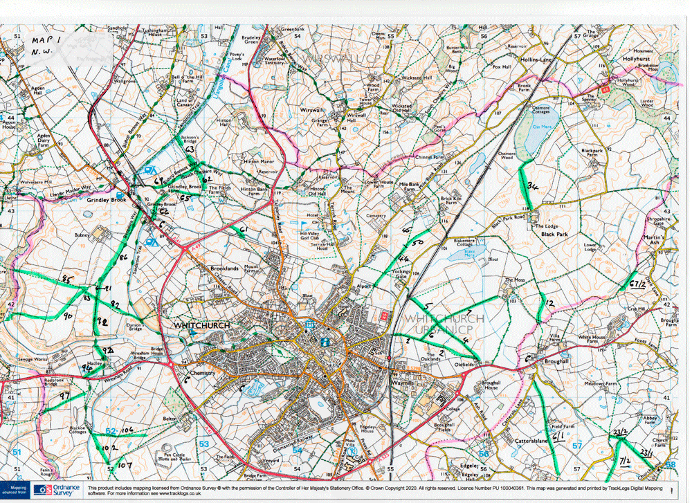
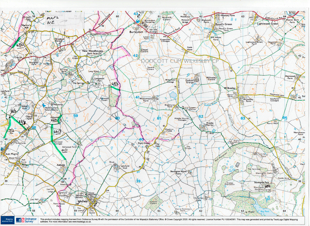
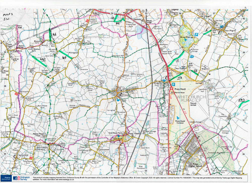
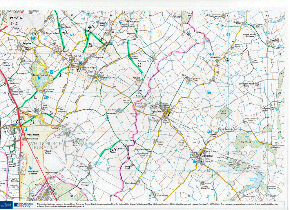
The numbers for paths commonly affected by cropping in Whitchurch
Urban and Whitchurch Rural parishes can be found on the relevant map
below. Click on the map to enlarge and use the magnifier to enlarge
again.
Maps of Whitchurch
Urban (0234), and Whitchurch Rural (0233)
The maps are: Map 1 North West of Whitchurch, Map 2 North East, Map 3 South West, Map 4
South East.
There is some overlap. Parish boundaries
highlighted in pink.
Rights of Way that are
highlighted in green are ones which were cropped with maize last
year, or where a crop prevented access, or where ploughing has been seen very recently.
Path numbers are given
in black.
Whitchurch Urban
(prefix 0234) has just the number, Whitchurch Rural (prefix 0233) the
number is underlined.
Need to report
cropping, especially maize, where a path has not been made. This
will not become obvious until early June.